A Brief History of The Silk Road
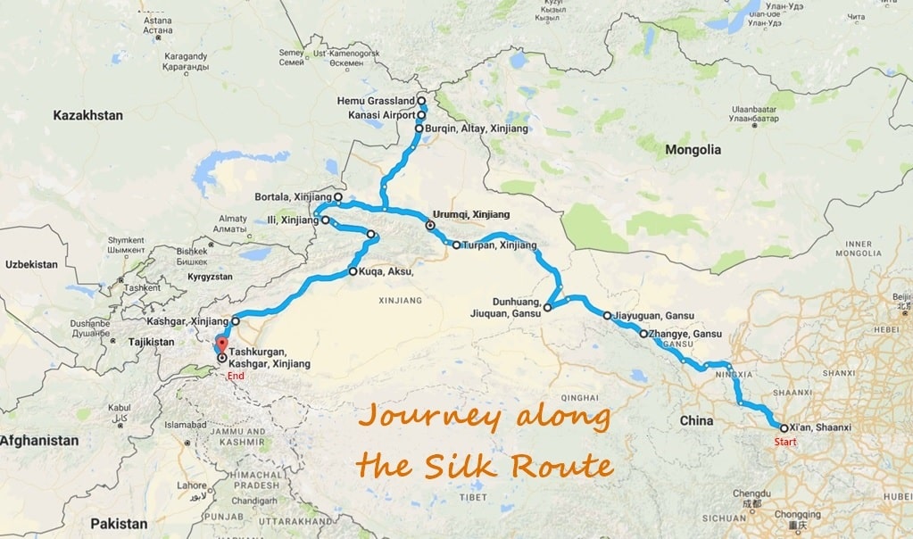
Stretching over 7,000 km the Silk Road (aka Silk Route) connected China to Europe for over 2,000 years. From Alexander the Great, so instrumental in creating an uniform economic and cultural world stretching from the Straits of Gibraltar to the Indus River (330 – 325 BC), to Genghis Khan who triggered the Mongolian domination, Eurasia was crisscrossed with trades of silk and commerce for many centuries. This resulted in a fusion of ethnicity, religion and culture unique in history.
Beginning at the ancient Chinese city of Chang’an (Xi’an西安), the Silk Route took traders westward from the Hexi Corridor to the barrier of the Great Wall, then along the northern borders of China, India and Persia, ending in Eastern Europe near today’s Turkey and the Mediterranean Sea.
The Silk Road gave rise to unprecedented trade, but its glory is also in the exchange of ideas and culture; a picture of diversity and tolerance too. In the 15th century under the Ming Dynasty, the Silk Road was eventually abandoned when alternative sea routes; speedier, higher capacity and relative cheap were discovered.

Replicating The Silk Route
Last September, a group of us, 19 to be exact, decided to replicate the epic journey of these early explorers. No, we didn’t do it on camels 🙂
Travelling in more comfortable and speedier modes of transport it took us 18 days and 100 hours on the road to traverse more than 6,000 km. We didn’t cover the full Silk Route but it gave us a first-hand experience of how early trade (114 B.C. to the 1450s) was carried on against incredible odds by caravans of merchants and animals travelling over blistering deserts and snowbound mountain passes.
Apart from the history, the diversity of scenery and ethnic people along the way were awe inspiring.
Below is my pictorial travelogue of our 18-day journey. Photos by Niam CL, our Photographer-in-Chief.
Pre-trip Stayover at Xi’an
6 Sep 2016: The journey began in the ancient city of Xi’an, the capital of Shaanxi Province in central China. It is also home to the 2,000-year-old Terra-cotta army. Once known as Chang’an (Eternal Peace), it marks the Silk Road’s eastern end and was home to the Zhou, Qin, Han and Tang dynasties’ ruling houses.
We arrived in Xi’an from Singapore in the afternoon and stayed over for the night in preparation for the long trip west.
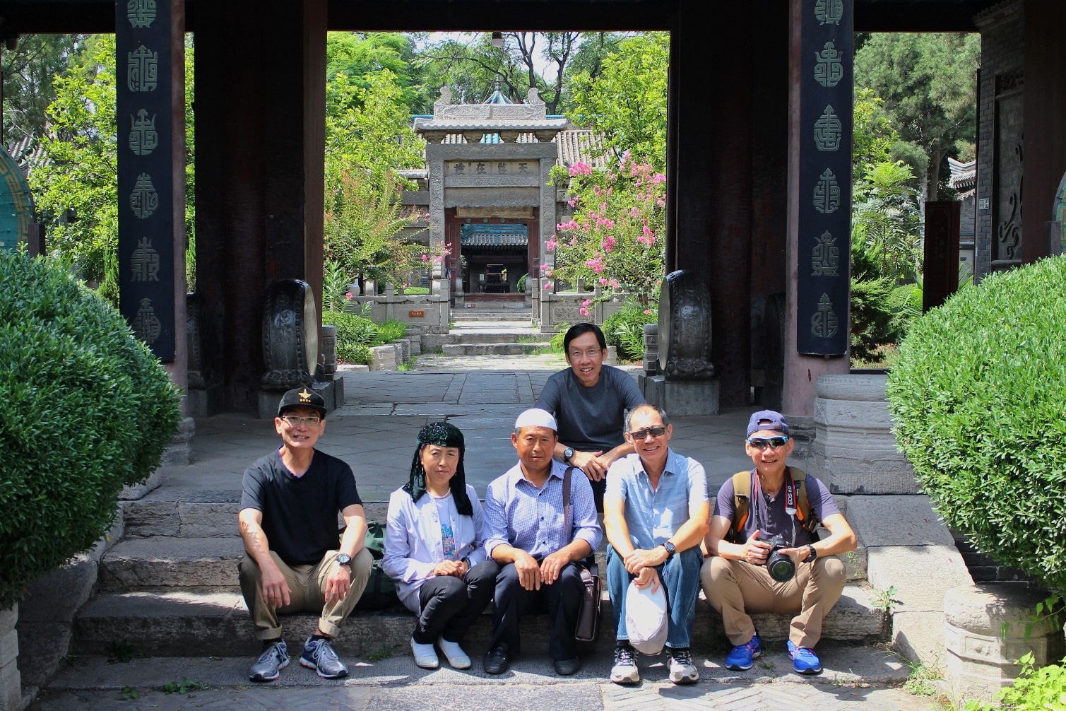
We visited the Great Mosque of Xi’an (西安大清真寺), built during the Tang dynasty (618-907 AD). It is the oldest and one of the most renowned mosques in the country. A few of us pictured here with a couple of the Hui Chinese ethnic group; linguistically similar to Han Chinese with the exception that most of them practice Islam.
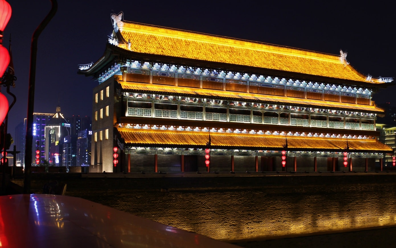
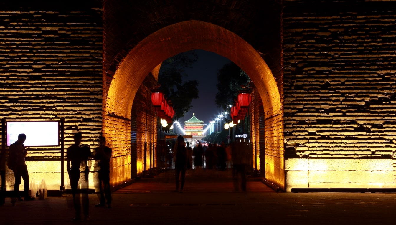
South Gate (永宁门), Xi’an City Walls
The South Gate was built during the old Tang Dynasty (618 – 907 AD) in order to fortify the city. It has been restored, beautifully decorated and opened to the public in 2014. Today important ceremonies organised by the Provincial Government are held in this Square.
Zhangye (张掖)
9 Sep 2016: An important outpost and a stopover along the Hexi Corridor; a long 1,200 km passageway of the ancient Silk Road that offered the only feasible way for travellers leaving or entering China to or from Central Asia and the West.
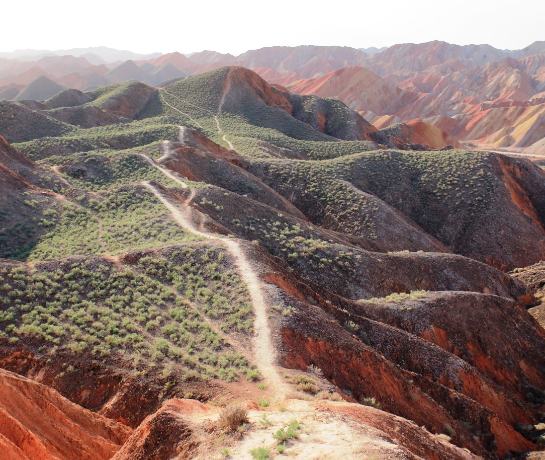
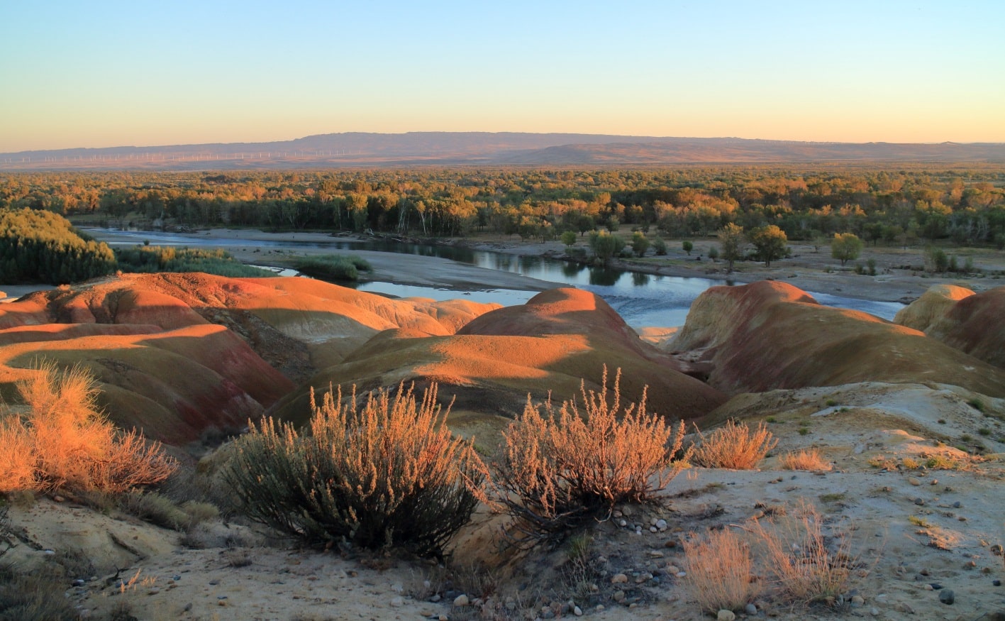
Zhangye Danxia landform (丹霞地貌) – hilly red sandstone and mineral deposits that were laid down millions of years ago like slices of a kueh lapis (an Indonesian traditional snack like layered cake). Wind and rain carved amazing shapes into the rock, forming natural pillars, towers, ravines and valleys. But a word of caution: many online pictures of these hills are far-fetched – rainbow-coloured and very vibrant. Always find it best to temper expectations 🙂

Jiayuguan (嘉峪关)
10 Sep 2016: Home to the western end of the Great Wall, Jiayuguan was once a key trading post of the ancient Silk Road. The Overhanging Great Wall was first constructed in 1539. The mountain-view and vast plains of the Gobi desert surrounding the place were stunning.
[photogrid ids=”2590,2589,2588,2587″ captions=”yes” columns=”five” fullwidth=”yes” ]
Dunhuang (敦煌)
11 Sep 2016: Serving as the westernmost fort of the early Tang Dynasty, Dunhuang was not only a key trading post situated on the Silk Road but also the military headquarters. The economic, military, political and cultural activities which took place at these cross-roads provided the basis for the flourishing of one of China’s earliest Buddhist centres.
The Mingsha Sand Mountain (鸣沙山) of the Gobi Desert – interesting experience going from urban living to total desert. Climbed the dunes and walked around the desert area.
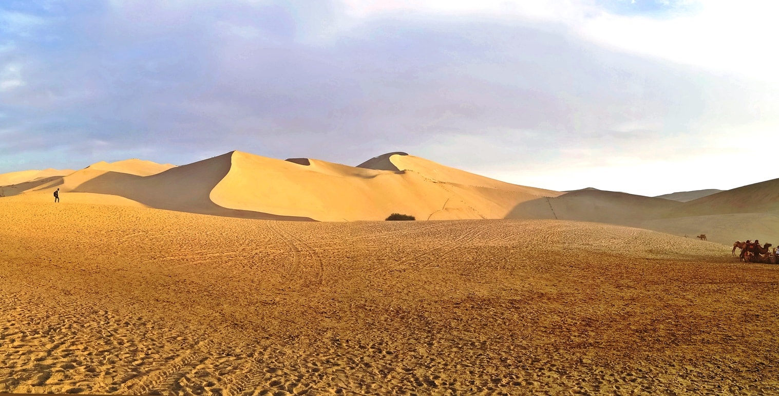
Crescent Lake (月牙泉) – named for its distinctive shape. The lake and a 2,000-year old oasis are surrounded by the sand dunes of Mingsha Mountain.

Dunhuang (敦煌) – Mogao Caves (莫高窟)
12 Sep 2016: Amazing 5th and 6th century painted caves cut into the side of a cliff served as places of pilgrimage and worship. The frescoes and sculptures discovered here represent one of China’s most significant archaeological finds.
[photogrid ids=”2594,2595,2596,2597,2598,2600″ captions=”yes” columns=”five” fullwidth=”yes” ]
Turpan, Xinjiang (新疆,吐魯番)
13 Sep 2016: Turpan was one of the largest on the Silk Road and the most important for Gobi desert portion of the road. It is also known as China’s Death Valley. At 154m below sea level, it is the second-lowest depression in the world and the hottest spot in China. In July and August, temperatures soar above 40°C and sometimes even 50°C.
[photogrid ids=”2609,2608,2607,2606″ captions=”yes” columns=”five” fullwidth=”yes” ]
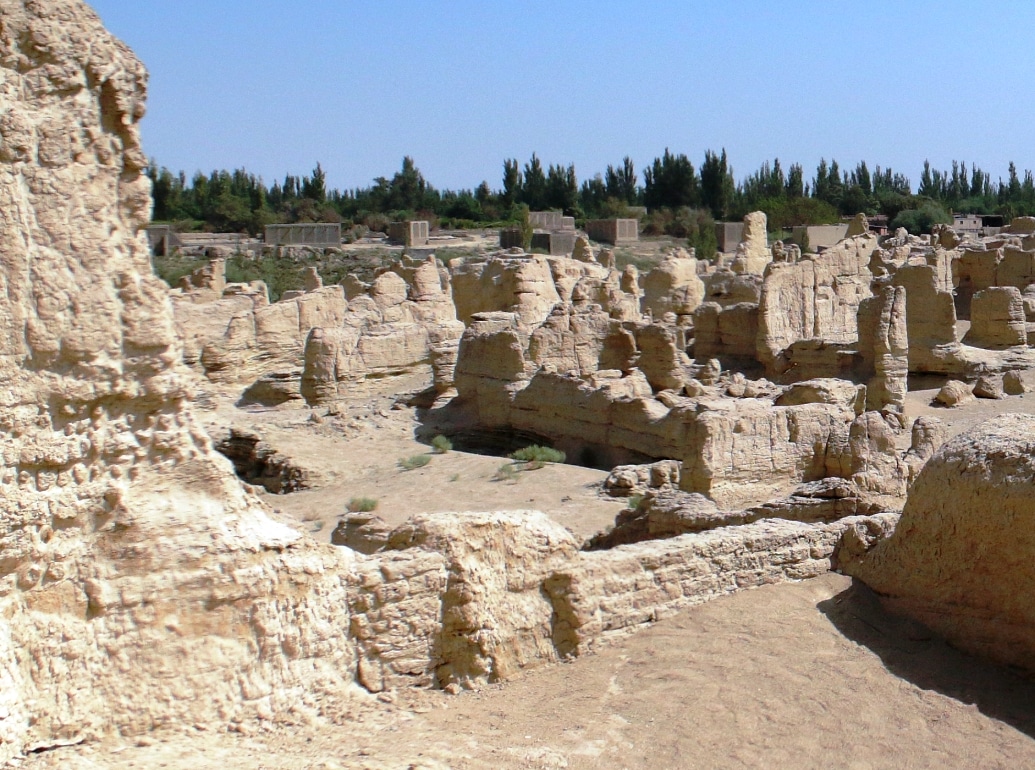
10 km west of Turpan lies the ancient city of Jiaohe (交河故城), one of the world’s architectural wonders. Hidden in the Yarnaz Valley like a willow leaf between two rivers on a plateau atop a cliff, this historic city of Jiaohe has a history of 2300 years. Established during the Western Han Dynasty (206 BC) the place has crumbled and left as ruins due to years of fighting in Turpan at the end of Mongol’s Yuan dynasty (1206-1368). The remains are pretty beaten, but it’s a beautiful spot to wander around for an hour or so.
Urumqi, Xinjiang (乌鲁木齐)
13 Sep 2016: Capital of Xinjiang Uyghur Autonomous Region in Northwest China, Urumqi was a major cultural and commercial hub on the Silk Road during China’s Tang dynasty. This is the big tower in the International Grand Bazaar compound. Around the base is this beautiful bas-relief sculpture depicting the “Twelve-Muqam (melody type)” musical tradition of the Xinjiang region.
[photogrid ids=”2614,2613,2612″ captions=”yes” columns=”four” fullwidth=”yes” ]
Karamay, Xinjiang (克拉玛依市)
14 Sep 2016: From Gansu Province, we crossed into Xinjiang, an autonomous territory in northwest China. It comprises roughly one sixth of China’s total landmass. A vast expanse of territory with a varied topography. Karamay, a unique landform about 100 km away from the oil-rich town, is also known as the Ghost City (魔鬼城) for when the winds or sand storms rise, they roar through the town like howling ghosts 🙂
[photogrid ids=”2618,2617,2616″ captions=”yes” columns=”three” fullwidth=”yes” ]
Burqin, Xinjiang (布尔津)
14 Sep 2016: Today we came close to the Russian and Kazakhstan’s borders. Rainbow Beach (五彩滩) is an area of rock formations along the meandering Ertix Riverbank. An interesting landscape; almost like being on a beach on one side (south bank) and in the desert on the other (north).
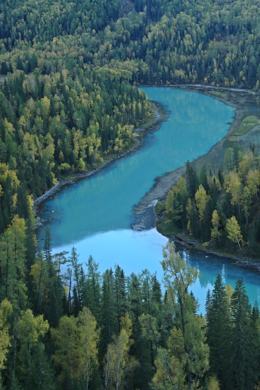
15 Sep 2016: In Mongolian, “Kanas” means “the lake in the valley”. Kanas Lake is just like a beautiful painting. Originating from the Kanas Glacier in Altay Mountain, the Kanas River runs through the mountains for about 125 km. The lake is 1,375 m high above sea level and covers an area of 45 sq. km.

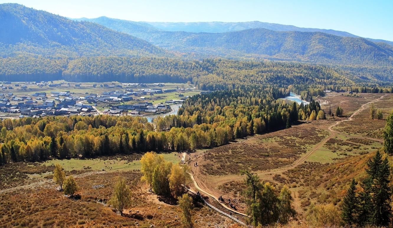
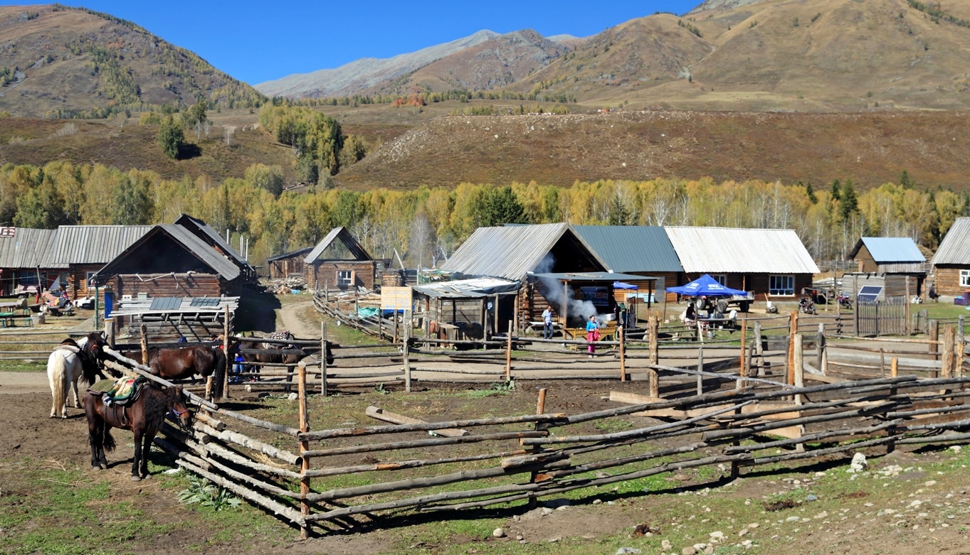
16 Sep 2016: At the intersection of the Kanas and the Hemu Rivers lies the Hemu (禾木) Village. Originally populated by the primitive Tuwa minority of Mongolian descent thousands of years back, today it is another commercial tourist destination.
Fukang, Xinjiang (阜康)
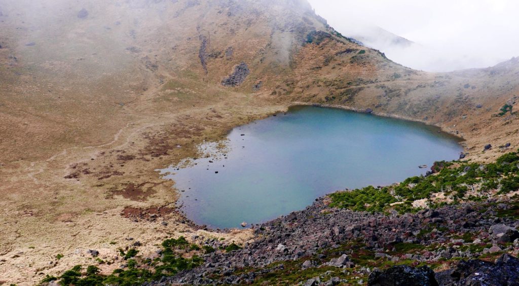
17-18 Sep 2016: Heavenly Lake of Tianshan (天池). A substantial uphill hike but well worth the trek for an amazing view of the beautiful lake with its greenish blue water in a rugged mountain setting.
[photogrid ids=”2630,2629,2628″ captions=”yes” columns=”three” fullwidth=”yes” ]
Ili (Yili), Xinjiang (伊犁)
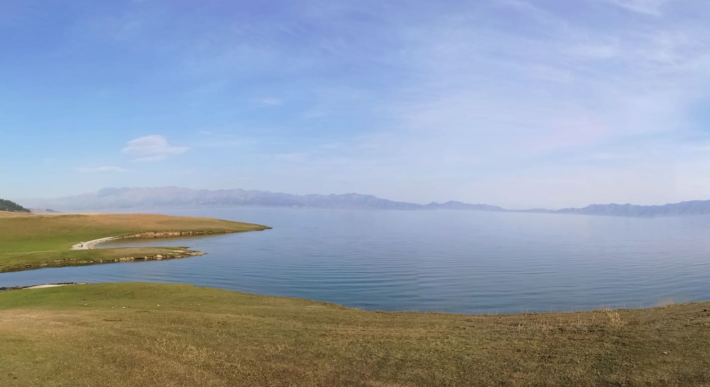
17-20 Sep 2016: Sayram Lake (赛里木湖). It is the largest (458 sq. km) alpine lake in Xinjiang and at an altitude of 2,070 m. Such tranquility!
Home to the Kazakh community, a nomadic people who herded livestock on the vast steppe. The rolling hills are dotted with their yurt camps and their herds of goats, sheep and cows, grazing on lush green meadows.
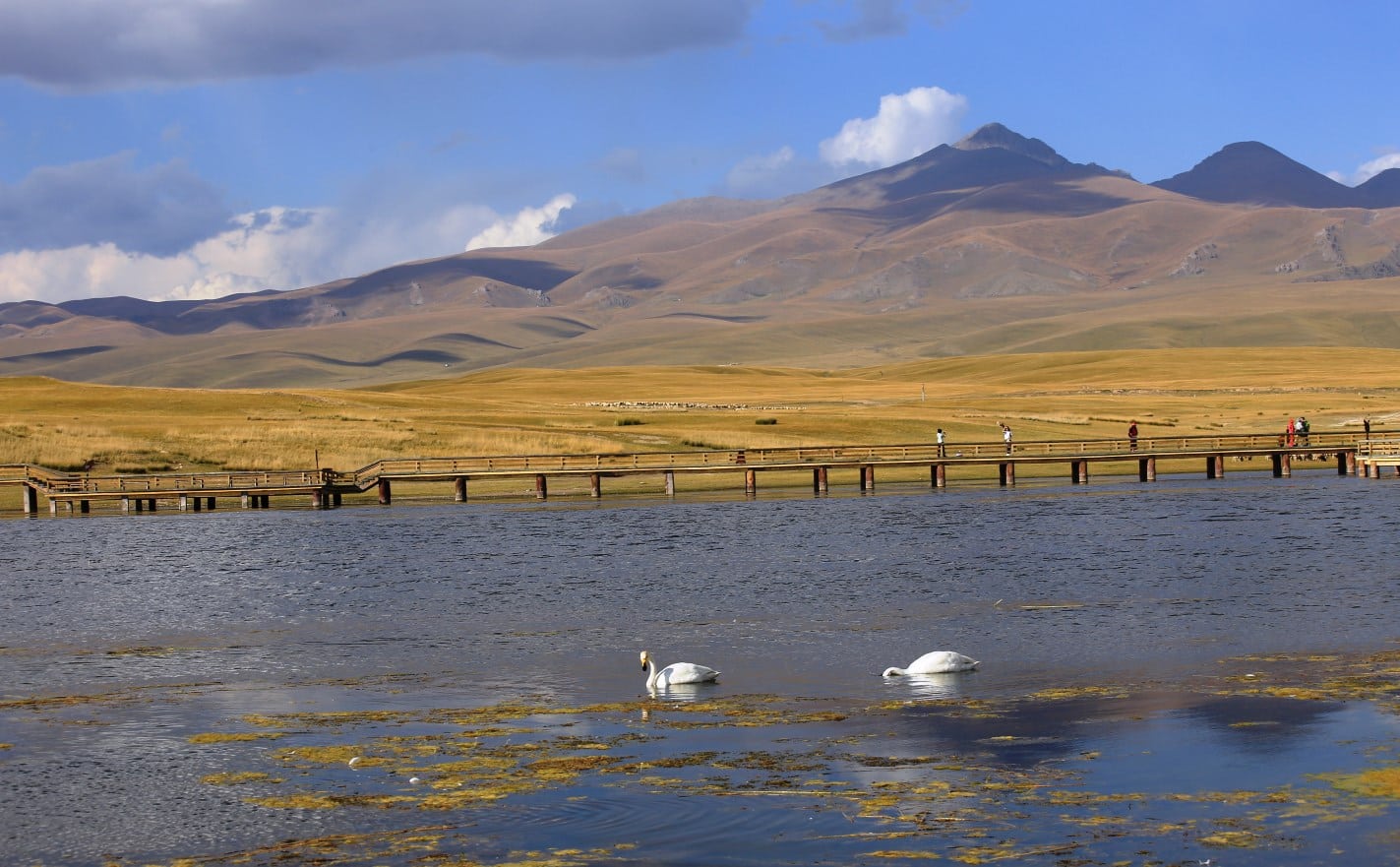
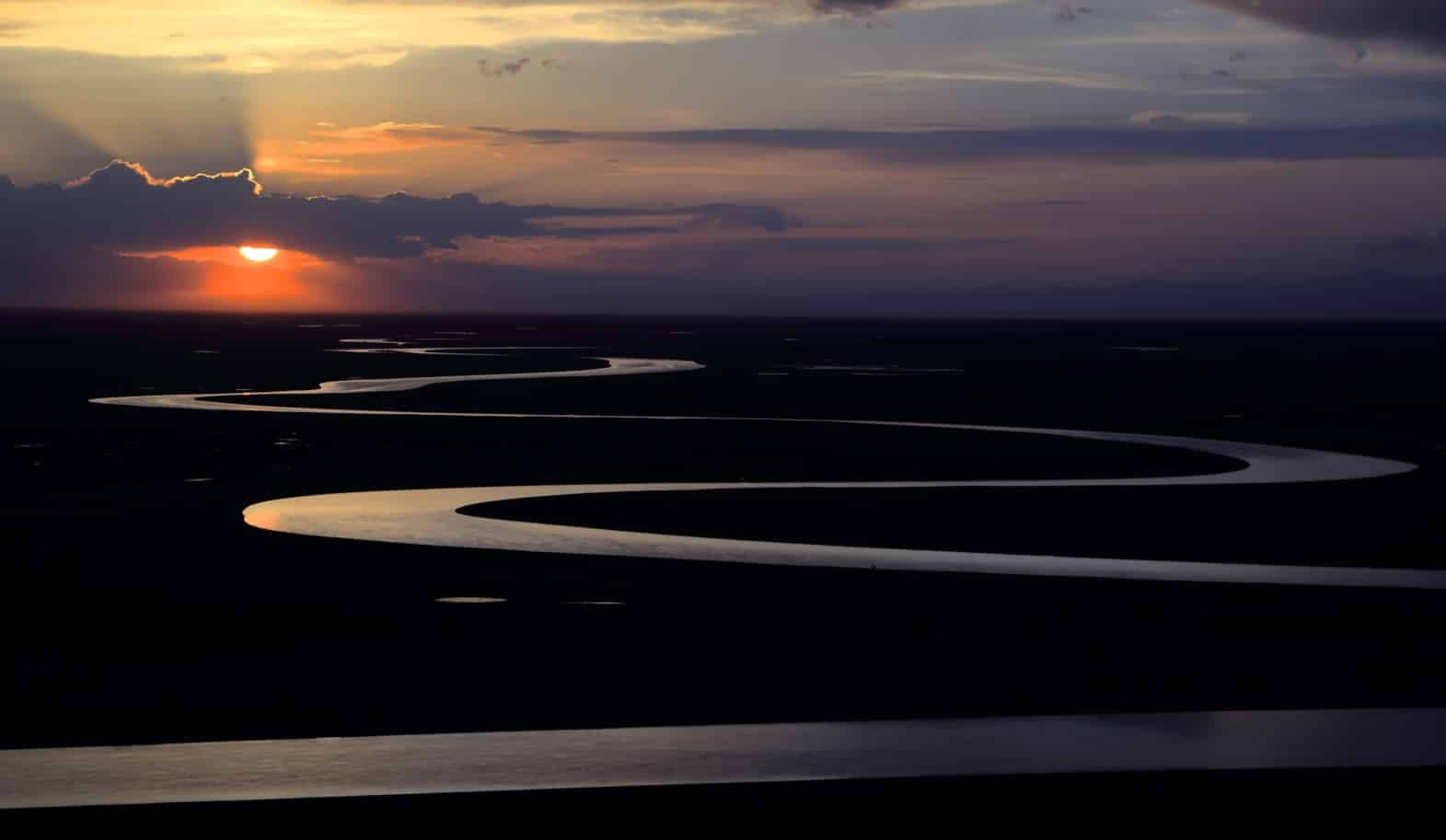
The amazing Bayinbuluke grassland (巴音布鲁克草原). Located in the middle of Tianshan Mountains and all year round surrounded by snow-capped mountains on its four sides. It sits on a sea level of 2,500 m with an area of 22,000 sq. km; one of the largest grassland in China. The snowmelts from the mountains form beautiful zig zagging streams and small connected lakes.
[photogrid ids=”2636,2635,2634″ captions=”yes” columns=”three” fullwidth=”yes” ]
Bayinbuluke Swan Lake (foreground) is also a nature reserve for the swans. Every spring, swans from India, Pakistan, and even as far as the Black Sea and the Mediterranean flew in droves to their breeding habitat in Bayinbuluke.

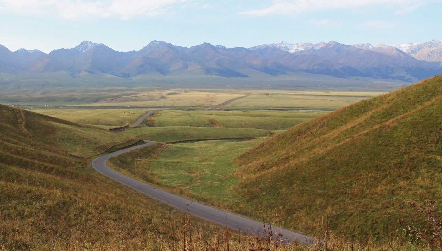
21-Sep 2016: S216 highway: jaw-dropping scenic drive past Tianshan Mountain range to Kuqa.
[photogrid ids=”2645,2644,2642,2641″ captions=”yes” columns=”four” fullwidth=”yes” ]
Kuqa, Xinjiang (库车)
22 Sep 2016: Kuqa is a Silk Road oasis town on the northern edge of the Taklamakan desert, about halfway between Kashgar and Turpan. One of its main attractions is the Grand Kuqa Mosque, the place for Muslim people in Kuqa to worship the God. It is located in the highest place of Heidun Bazaar in Kuqa County. After the spread of Islam in Kuqa, the Grand Kuqa Mosque was built in the 15th Century and reconstructed in 1931 after being damaged by fire, which first signified dominance of Islam over Buddhism in Xinjiang.
The main dome of the Grand Mosque over the entrance was built with 300,000 eggs and cement mixture. The great praying hall is supported by 88 pillars, embellished with carved designs and in many colors, a fine example of Uygur architecture. It can accommodate 1,000 worshipers.
[photogrid ids=”2653,2652,2651,2650,2649,2648″ captions=”yes” columns=”four” fullwidth=”yes” ]
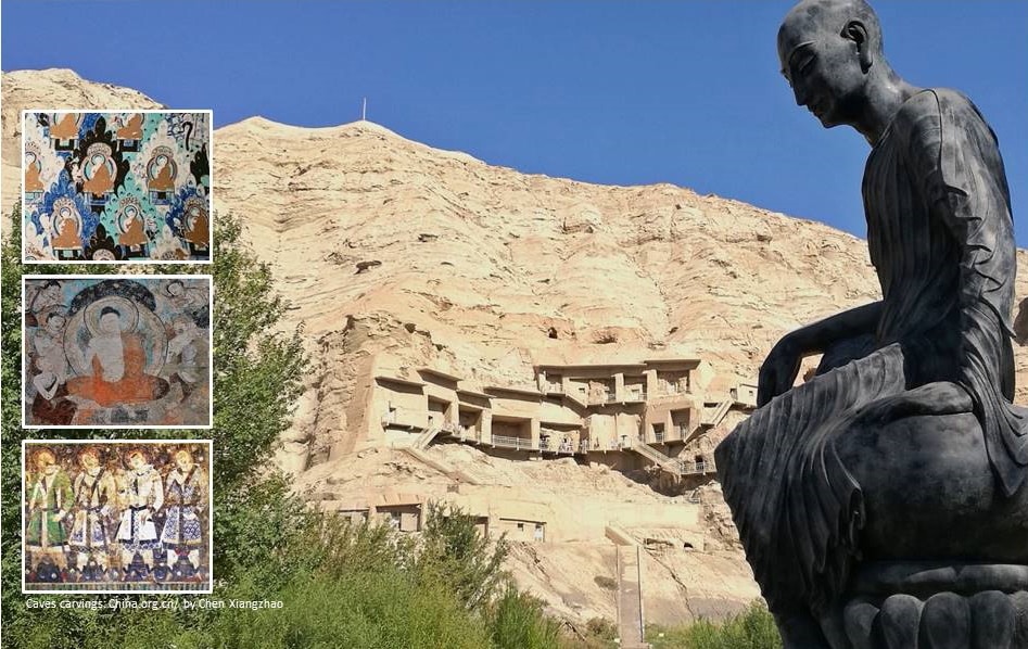
Kizil Buddhist Caves (300-400 A.D.)
There are 236 known caves or grottoes carved into the cliff from east to west, spanning a length of 2 km. During the 7th and 8th centuries, conquests by Muslim empires that spread Islam to the area and caused the decline of Buddhism and the Kizil Caves fell into ruin and were systematically pillaged over the centuries.
Tianshan Canyon
Surrounded by mountains on three sides, the reddish-brown canyon comprises different shapes, gullies and deep trenches.

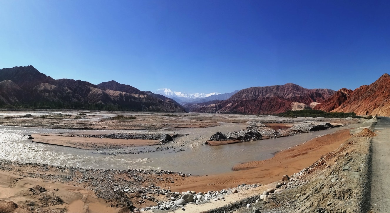
23-Sep 2016: On the Karakoram Highway (喀喇昆仑公路) end route to the Karakul Lake. It follows one of the paths of the ancient Silk Road between China, Central and South Asia. This highway, which connects China to Pakistan, winds its way through the majestic, snow-capped Pamir Mountain Range on the north and the Tibetan Plateau on the north-east. Lots of ongoing roadworks though so the bus ride was backbreaking for a stretch of more than 150km.
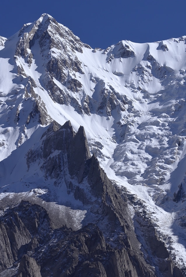
Karakul Lake (卡拉库里湖)
23 Sep 2016: Karakul Lake (卡拉库里湖) means “Black Lake” in Kirgiz. Karakul is an unusual plateau lake in the Pamir Mountains. At an altitude of 3,600m, the view is stunning, thanks to the surrounding, snow-covered mountains and crystal-clear water whose colour ranges from a dark green to azure. One of highest peak there, Muztagh Ata (7546m) is in the background.
[photogrid ids=”2664,2663,2662,2661,2660″ captions=”yes” columns=”five” fullwidth=”yes” ]
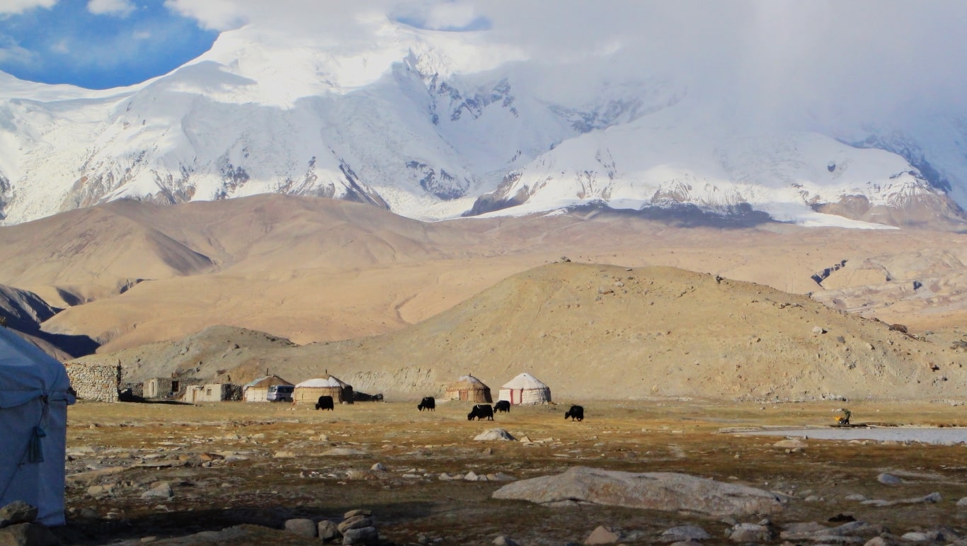
Along the shore of Karakul Lake, a community of Kyrgyz people survive through nomadic herding of yaks, sheep and goats. Yurts – circular tents pitched by nomadic tribes are their traditional dwellings.
Kashgar (喀什)
24 Sep 2016: Kashgar (喀什) is in the southern Xinjiang region on the edge of the Taklamakan Desert. The city was once a significant trade centre of the Silk Road for merchants. Now, it is the hub connecting China and Central Asia. The 2,000-year old Stone City was once a regional capital during the Han Dynasty. It is also the movie location for The Kite Runner.
[photogrid ids=”2672,2670,2669,2668″ captions=”yes” columns=”five” fullwidth=”yes” ]
On the final leg of the journey before heading home, we walked through the alleys of Kashgar Old Town. Took a tour of the largest mosque in China, Id Kah Mosque (built in 1442) covering 16,800 sq m and accommodates up to 20,000 worshippers!
[photogrid ids=”2679,2678,2677,2676,2675,2674″ captions=”no” columns=”four” fullwidth=”yes” ]
Visited the Apak Khoja Mausoleum (Tomb of Xiang Fei) and heard the fascinating story of the Fragrant Concubine – the only Uyghur concubine among the wives of Emperor Qianlong during the Qing Dynasty (1644-1912). The entire complex comprising the mausoleum, prayer hall and a courthouse is indeed a living monument of Uyghur history and Islamic architecture.
[photogrid ids=”2686,2685,2684,2683,2682″ captions=”yes” columns=”four” fullwidth=”yes” ]
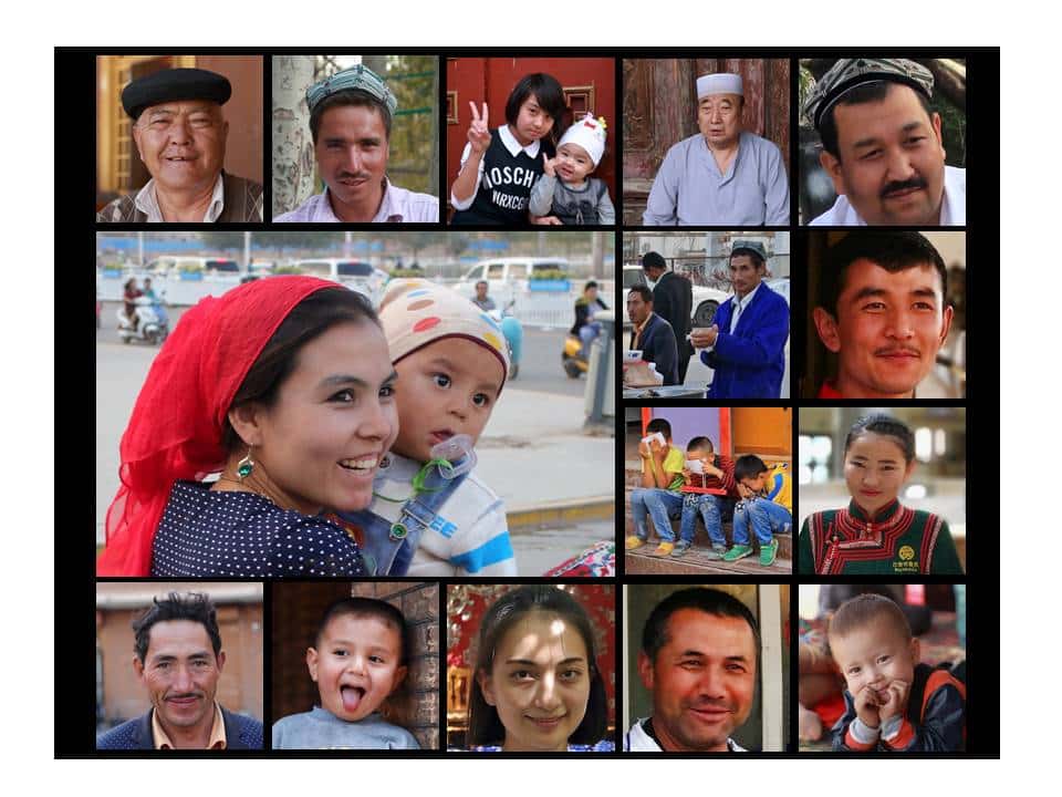
During our 18-day trip we met many friendly locals who taught us much about their culture and their history. Here are some of our new found friends…
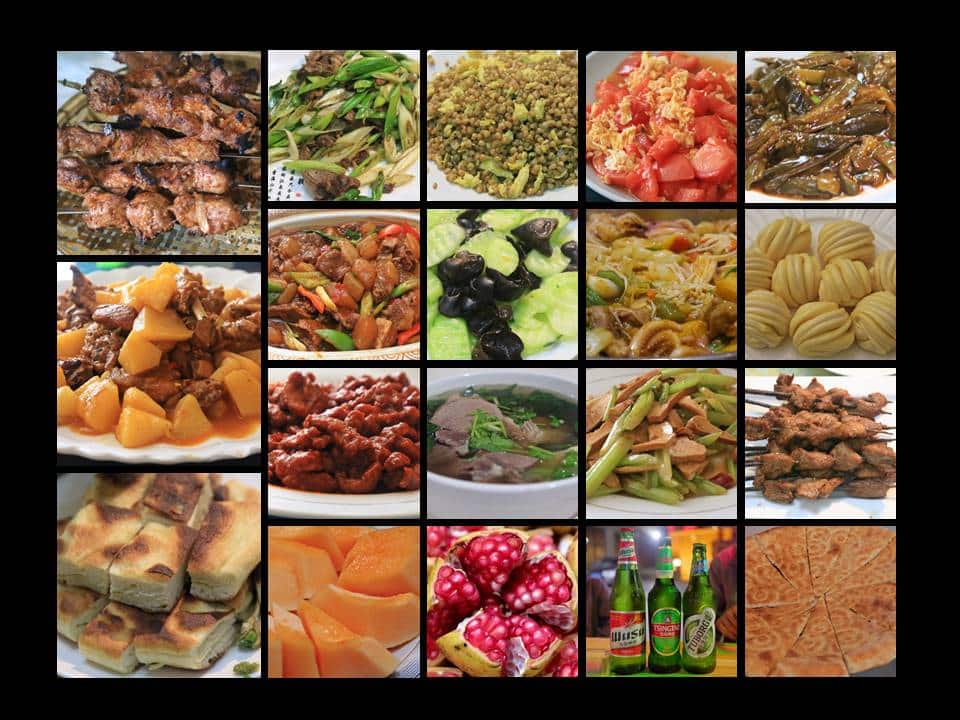
Good Eats From Xinjiang
Because of the Muslim population, Xinjiang food is predominantly halal. Popular cuisines include Da’pan’ji (Big Plate Chicken 大盘鸡) and Kao’rao (Kebabs 烤肉串). Baked flatbread (Naan 馕) and hand-made noodles (la’mian拉面) and are the main staple food.
Here’s a 2 part video documentary of our trip:
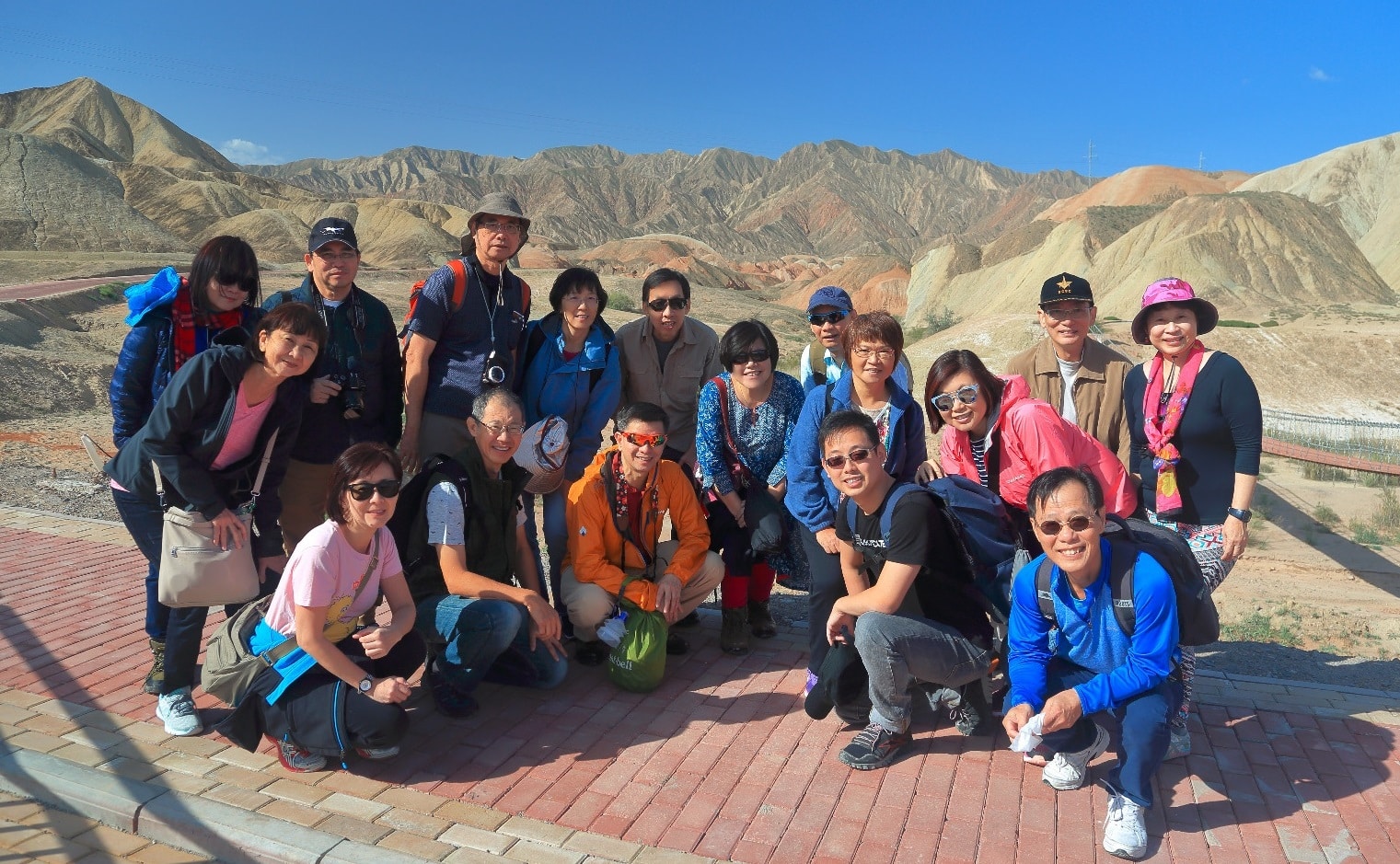
Photo and video credits: Niam CL
Other travel stories you may find interesting:
- Face to Face With the Wind and Thunder Gods
- Exploring Arashiyama and Ancient Kyoto
- Tsukiji Tuna Auction Experience
- A Night in Venice

- 18-Day Journey Along the Silk Route - May 17, 2017